Journey to Confidence | Trips From an Adventurer
Everyone starts somewhere, right? Author and adventurer Dunc Wilson has tramped all over the country. Here he shares some of the tracks that helped grow his confidence in the wild. Grab your pack and let’s get going!
Around a decade ago, a couple of pals and I started exploring Auckland’s Waitākere Ranges and I became hooked on hiking. We obsessed over the maps, our goal to complete every track in the park. In late 2014, we got there. Going on foot allows you to reach some of the most untouched places there are.
Here are some of my favourite hikes and what they taught me about getting into the wild.
Header photo:Coffee at the final viewpoint above Whatipū.
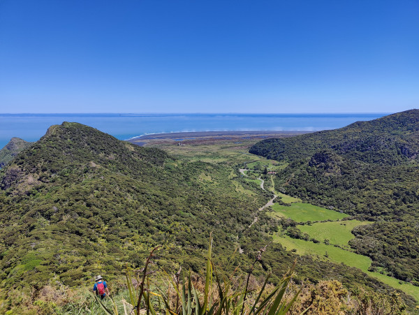
Whatipū from Omanawanui
Ōmanawanui Track, Waitākere Ranges, Auckland
Let’s start with that well-known tramping arena: the Waitākere Ranges. Once a gemstone of the city, skipped by tourists advised to “get out of Auckland”, the park’s 250km network of tracks has been largely shut since 2018. Kauri dieback management has led many track upgrades and the forest is slowly reopening.
The standout, and most popular, has to be Ōmanawanui Track. I still recall my loud gasps of awe and amazement the first time I set foot on this track. It’s still this good!
From the top car park on Whatipū Road, the boardwalk weaves among young kauri and nīkau, occasionally teasing a glimpse of the vast Manukau Harbour views on offer.
A climb up the main summit follows, with the path often just centimetres away from the rugged cliffs. Do not go in strong winds! These days, the trig marker is skirted by an ocean-inspired boardwalk, where many choose to pause and take a break.
From here, the lively waves of the Tasman Sea take over the breathtaking views. A steep rock scramble is assisted by chains, which have survived the refit. Necessary or not, chains on a tramping track are always fun.
The final descent then offers more views over Whatipū Beach, from Signal House Track, or a walk on the beach itself if you continue down.
Take a look at Plan My Walk for more info. Ōmanawanui is an out-and-back hike, so you'll need to return the way you've come, or leave a second car in the beach car park. Although, with a number of tracks now reopened, you'll be plotting a multi-day trek through the “Waitaks” before long!
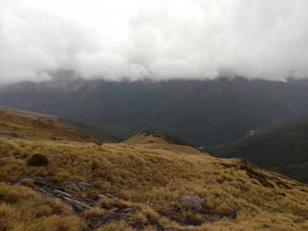
Brewster Hut from the slopes of Mt Armstrong
Brewster Track, Mt Aspiring National Park, Otago
Trekking above the treeline, to spend a night in a hut, surrounded by glaciers and clouds is a great way to bolster and hone your hiking skills and experience.
Brewster Track is an excellent way to dabble in many of the various terrains you might encounter in the Kiwi backcountry, without wandering too far from your car. It also has a neat hut, with some epic views.
Hazards exist from the moment you step from the car park and onto the rocky beach by Fantail Falls. It's here you must cross the Haast River. Make no mistake, the track notes might say 'Otago', but you are technically on the West Coast and that can mean rain; lots of rain. For this reason, take extra supplies in case a flood seals you up the mountain. The first time I attempted this one, I actually turned back and cancelled my stay based on a poor forecast. Check Plan My Walk for more current weather forecast and warnings to help plan ahead.
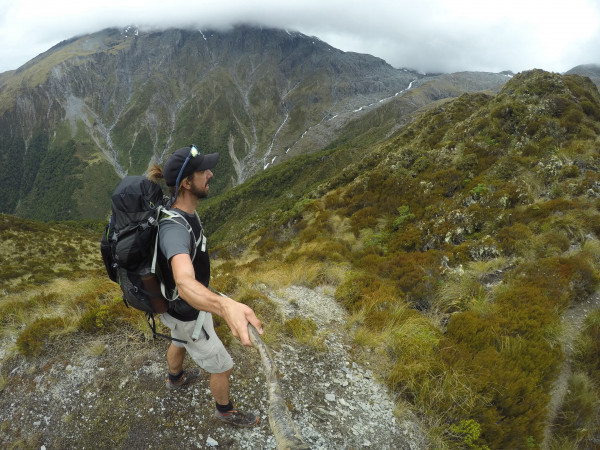
Brewster Track Looking into Pyke Creek with Brewster Glacier in clouds
Once safely over the river, you go on a diagonal journey through thick, native beech. Mosses cling to rocks, the damp ground spongy under foot. At times, things get very steep and tree roots provide a natural ladder of assistance.
After roughly 3km, you emerge at the very defined treeline. In rain, this section of track effectively becomes a stream. It also steepens once out in the tussocks, with rocks and earthy ledges providing necessary climbing aids.
Slender at times, the ridge offers views north into the Deep Pyke Creek and across to Warden Spur. You can even see the best road in the country, State Highway 6, winding its way down to the coast.
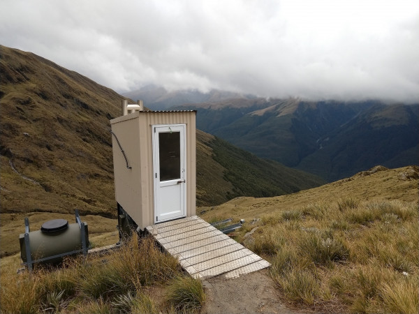
Brewster Hut's loo with a view
One last little push and the rust-red Brewster Hut pops into sight. It's not alone. Beyond it sits one of the country's lesser-known glaciers: Brewster Glacier. Crystal-clear ice water drains from its pool down into the creek.
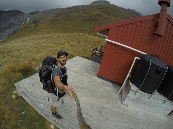
Brewster Hut with glacier behind in cloud
It’s an enchanting place to spend a night, a fact that cements itself as you head back down the same route the next day.
Broken Hills to Rangihau Rd, Coromandel Forest Park, Waikato
Ready for a hike and camp? Just a two hour drive from Auckland, Coromandel Forest Park’s Kauaeranga Valley is a fine wilderness destination. If you get up early enough, you can be in the heart of the backcountry before 9am!
‘Mixing and matching’ multiple tracks is a key skill I’ve learnt over time. Not all Topo map tracks are the same! However, joining them up allows me to make a route that suits my plans. The Kauaeranga Valley area has many options. You can use Plan My Walk for info and planning, then simply let your safety person know you’re intending to extend onto another track.
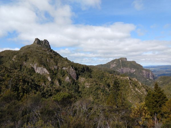
Pinnacles from Webb Creek Track
A challenging overnight option is the traverse from Broken Hills, near Tairua, to Rangihau Road, near Coroglen. I measured this epic as 27km. You can camp at either Billygoat Basin or Pinnacles Hut.
After being dropped at the Puketui Road end, I crossed the Third Branch of the Tairua River and walked west, towards the old tunnel. Ensure you have an appropriate light for 400 metres of darkness! Back in the daylight, I climbed Paton Stream Dam Track on the ridge up Hihi. Occasional breaks in the trees offered spectacular views of the Pinnacles.
Once on the tops, I negotiated the big bog, made eerier by the lingering mist and the many dead standing trees. This section’s a true backcountry delight. The descent to Billygoat Basin oversees a relatively sudden scenery change. From the marshy tops, I was now tramping over hard, stone and clay pathways. Tall wooden steps assist with the climbs on Billygoat Walk to join Webb Creek Track.
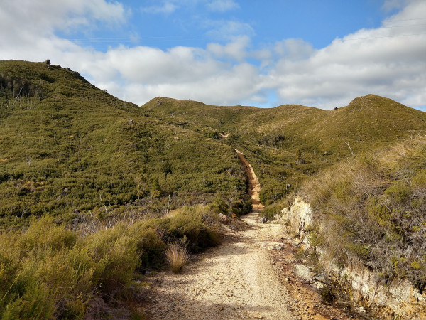
Coromandel Forest Park - Regenerating native bush on Rangihau Track
On Rangihau Track, a steep and worn path took me down to cross the upper Kauaeranga River. On the other side, it climbs steeply out of the valley, where younger, regenerating bush, surrounds the trail and nearby hills. The final 7km are largely downhill, with two final river crossings right before the road.
These are three of my favourite trips around Aotearoa. There’s a whole heap more in the Plan My Walk app, so check it for one near you, get planning and have fun!
- Read his other stories about an adventure on the water or cost saving with gear
- Follow Dunc and his adventures on his Instagram channel or website here