Up the Creek With a Paddle | An Adventurer's Story
A story from Dunc Wilson, an experienced multimodal explorer and author, who has some adventures to share from the land and water of our backyard. Every experience, good or bad, can be a lesson or inspiration for fellow outdoor enthusiasts, so, let’s go!
The rise in popularity of the packraft has driven an increase in multimodal adventuring. What does that mean? When a journey utilises two or more transport modes - bike, hike, raft, etc - then it might be called multimodal.
I’m a dreamer who’s often longed to cross that giant lake at the end of a hike. Haven’t you? Naturally, when I discovered packrafts, I snapped one up and began exploring our backyard from new angles. One thing led to another and I found myself on a packraft (and hiking) expedition across the length of Aotearoa-New Zealand. I call it my Waka (canoe) & Waewae (feet) Journey!
Here’s a tale from Day 25 of this journey, my third and final day on the Great Lake Taupō. I planned to travel from Motutere to Tūrangi. However, as we’ll see, things didn’t quite go to plan.
As with any thru-journey, plenty of planning and gear shopping was undertaken before setting off. Each day then requires a headfirst submersion into local maps, trail info and land access rights, to find the possible. I look at the Topo map of the area, any tracks, contours and ask myself “where can I get to?”. I’ll also check the DOC website, Plan My Walk app, or other local sources.. This helps me estimate the difficulty and the terrain. Other write ups from fellow adventurers, bloggers and locals can also be valuable. I don’t think you can have too much information on an area.

Motutaiko | Dunc Wilson
For this day, this was the plan: paddle from Motutere for a lap around Motutaiko - the great lake’s lone island - before heading south towards the Motuoapa peninsula and southwest across Stump Bay. At the western end of the bay, I would follow the Tongariro River upstream for roughly 1km to a 4WD track. I would then convert to land mode and hike the remaining 8km into Tūrangi. If I couldn’t get up the river for any reason, my contingency was to paddle round to a boat ramp on the Tokaanu Canal and walk from there. It all appeared simple, even if the required physical effort wouldn’t be. Follow the steps, what could go wrong? Well, there’s always something; it’s about managing those risks.

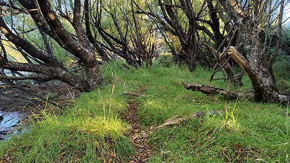
Overgrown 4WD track | Dunc Wilson
The morning arrived and I gave the weather a final check. The window of light breezes and cloud over a warm, sunny day was to continue. Perfect for lake rafting.
Despite carrying a PLB and a mobile phone (in dry bags!), my siblings back home were briefed on my intentions. There really is no substitute for this. The Plan My Walk app even lets you share your plans quickly and easily, with your safety buddy. Cell coverage around Taupō is good, so I would easily be able to let them know of my whereabouts at the end of the day.
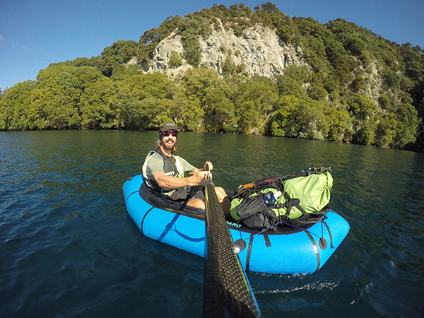
The raft remained inflated from the previous day, so I topped it up and strapped my pack to the foredeck. Setting off is always a joy. Jumping in, clasping the paddle and putting the plan into action feels so good.
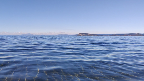
The day brought similar delights, as I circumnavigated the bush-clad island (which is tapu, so I didn’t land), lunched on a pumice beach near Te Rangiita (header photo) and marvelled at the towering cliffs of Motuoapa. Hot from the paddle across Stump Bay, I stopped on the black rock beach near the Tongariro River mouth and jumped in for a swim. It was incredible, the crystal water glimmering over the dark lake floor. A great way to celebrate the end of three waka days on Taupō Moana.

Reflections at Stump Bay | Dunc Wilson
Back in my boat, I neared the river mouth. Water was pouring out into the lake, creating some small waves. Nothing scary. A brief conversation with a man fishing from his boat ended with him wishing me “good luck” and I disappeared up the river.
Despite the opposing current, I made good headway and was soon looking at the bank where the track met the water. I landed on a small sandy beach and took a brief recce to check if the track existed. It seemed to, albeit a little overgrown. I packed the boat onto my pack and set off to roam the willow-clad river bank.
400 metres, that’s as far as I got. A monstrously overgrown gorse, stretching from the river across the track and into the shrubs to my right, stopped play. I was trapped, with only an hour until sunset.
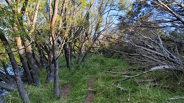
I found a tiny gap through some trees, which I squeezed through, then trampled over some brambles. This led to a clearing, littered with giant tufts of cutty grass. Great! Using my trekking poles for stability, I clambered over the razor-sharp pimples one by one, then followed a slender livestock track. This led into a small woodland, of which the floor was a swamp. This was fast becoming the backcountry embodiment of a horror movie!
Info online about this route had been scant, due mainly to the fact it’s a paper road and a seldom-travelled one at that! Plan My Walk has your back, however, in the form of alerts and reviews for all its listed tracks. Simply check the track’s details in the app to see if any fresh hurdles, like over-dominant exotic trees, have impacted others’ experiences of late.

Track blockages | Dunc Wilson
After following several false leads, I eventually found my way back to the river. This involved crawling on hands and knees under a bush. However, more overgrown shrubs hindered my passage to freedom.
I looked at my watch: it was time to call it; it was camp time. I messaged my siblings and told them what had happened, where I was and that I was fine to spend the night there. I would update them in the morning.
A flat-ish section, overlooking the river, was chosen as camp. It had everything I needed: running water and a way through the bushes to an appropriate toilet site.
I sat and enjoyed dinner to the sound of the river and the naughty possum, sat on the branch above my tent, dropping leaves on it. As I slurped my 4-minute noodles, I wondered: what would I have done if I didn’t have food, warm clothes and shelter?
- Read his other story about cost saving with gear and his top tracks
- Follow Dunc and his adventures on his Instagram channel or website here
Thanks for sharing your experience Dunc! If anyone else has hacks for the outdoors they think are useful to share, get in touch with us!