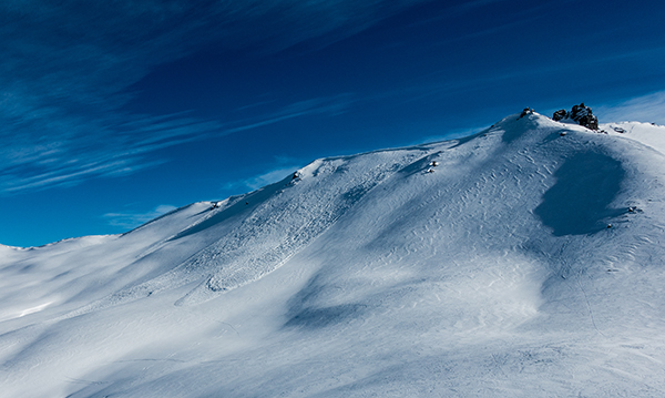
User backcountry photos improve safety information
A community data sharing initiative that encourages the public to submit avalanche sightings from New Zealand’s backcountry is proving to be highly successful.
MEDIA RELEASE October 2021 from the NZ Mountain Safety Council
This year, the New Zealand Avalanche Advisory (NZAA) public observations tool, which enables backcountry users to easily share their observations of avalanches and snowpack conditions has received over 200 submissions from across the country, including large scale destructive avalanches through to smaller and easily underestimated events that can still threaten the safety of mountaineers, skiers, trampers and hunters.
Each observation helps other backcountry users by providing an additional source of information which can be used to safely plan their trip. Most critically, these observations give the NZAA regional avalanche forecasters further insights into the conditions.
This type of data is incredibly helpful as it supports the development of accurate avalanche advisories, says the NZ Mountain Safety Council (MSC) Chief Executive Mike Daisley.
MSC operates the national avalanche advisory platform, the NZAA, which provides regional avalanche forecasts for 12 mountainous regions during the avalanche seasons.
Daisley says that while the overall amount and quality of snow tends to have a big impact on the number of public observations submitted each season, overall, there is an encouraging annual increase in the total number.
“This community data initiative is gaining traction, proving that publicly sourced data such as observations of the conditions can actively contribute to improved safety outcomes.”
Public observations are especially useful in areas where there are few or no commercial alpine operators like ski fields or heli-ski operators, Daisley says.

“You don’t need to be an expert to submit. A good photo of the conditions or of an avalanche path submitted promptly can provide valuable info to users and our avalanche forecasters.”
Queenstown-based NZAA forecaster Chris Cochrane has been in the role since 2002 and says that public observations help him to build a good understanding of the conditions when preparing a forecast.
“The NZAA has become a valuable tool for backcountry users because we can direct them to areas that are perhaps more sheltered and less dangerous, where some great conditions can be had compared to another area."
The public observations including photos are classified as ‘class 1’ data and are also used for scientific purposes by NIWA and the University of Otago.
The NZAA website underwent an update ahead of this current season to make it easier for those who are regularly using the site to find what they need, including the ability to search past public observations. The website was also awarded bronze in the 2020 Best awards for the ‘best user experience design’ category.
PHOTOS: Header: Jonathan Crane, Pleasant Valley - 2021, Content: Nick Shearer, Tower Ridge, 2019